Mount Kilimanjaro in Tanzania has a very unique appearance in relation to other giant mountains of the world. First of all the upper reaches of the mountain are not covered in ice and snow, and the sparse vegetation at the top give the mountain a dark chocolate colour. Second is the volcanic crater in the middle of the flat top. It reminds me of a big mound of chocolate sprinkled lightly with whip cream.
Kilimanjaro, with its three volcanic cones, Kibo, Mawenzi, and Shira, is a dormant volcanic mountain in Kilimanjaro National Park, Tanzania. It is the highest mountain in Africa and the highest free-standing mountain in the world at 5,895 metres or 19,341 feet above sea level (the Uhuru Peak/Kibo Peak).
Kilimanjaro is composed of three distinct volcanic cones: Kibo 5,895 m (19,341 ft); Mawenzi 5,149 m (16,893 ft); and Shira 3,962 m (13,000 ft). Uhuru Peak is the highest summit on Kibo’s crater rim.
Kilimanjaro is a large stratovolcano. Two of its three peaks, Mawenzi and Shira, are extinct while Kibo (the highest peak) is dormant and could erupt again. The last major eruption has been dated to between 150,000 and 200,000 years ago.
Although it is dormant, Kibo has fumaroles that emit gas in the crater. Several collapses and landslides have occurred on Kibo in the past, one creating the area known as the Western Breach.


![adeadvlei-17[6]](https://markozen.com/wp-content/uploads/2023/07/adeadvlei-176.jpg)
![adeadvlei-8[2]](https://markozen.com/wp-content/uploads/2023/07/adeadvlei-82.jpg)
![adeadvlei-9[5]](https://markozen.com/wp-content/uploads/2023/07/adeadvlei-95.jpg)
![adeadvlei-16[2]](https://markozen.com/wp-content/uploads/2023/07/adeadvlei-162.jpg)
 Abgestorbene Akazien im Dead vlei, Namibia
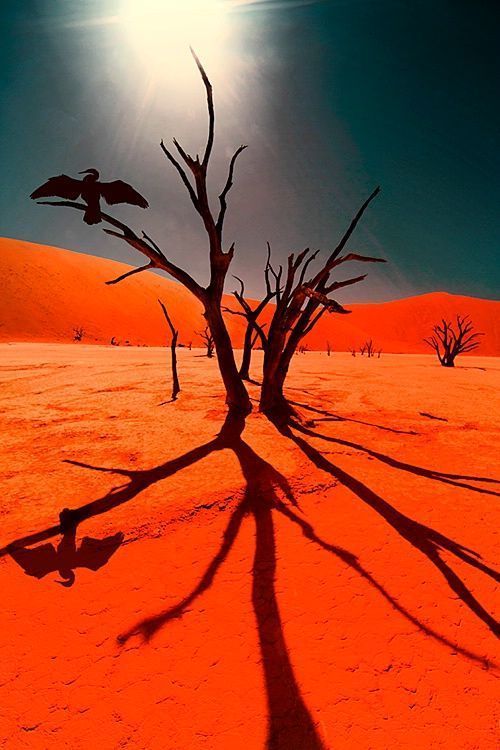


