The People that Live on the Sea

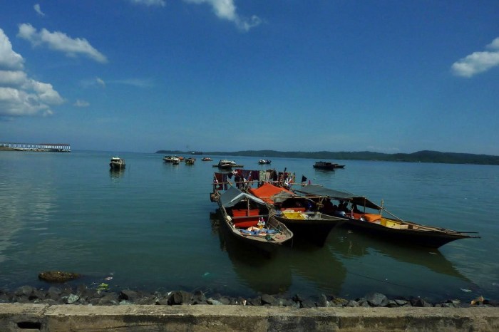
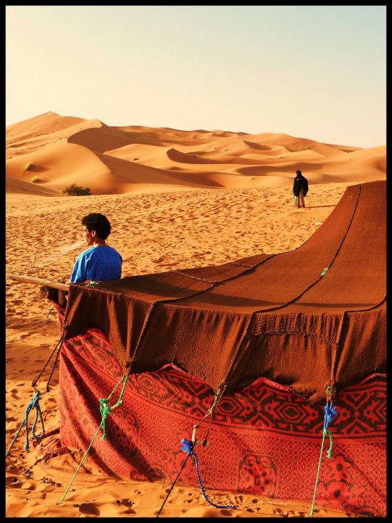
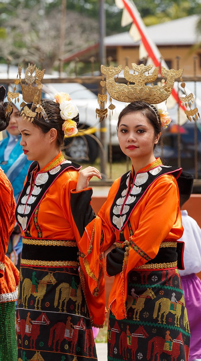
The Sama-Bajau refers to several Austronesian ethnic groups of Maritime Southeast Asia with their origins from the southern Philippines. They usually live a seaborne lifestyle, and use small wooden sailing vessels.

The Sama-Bajau are traditionally from the many islands of the Sulu Archipelago in the Philippines, coastal areas of Mindanao, northern and eastern Borneo, the Celebes, and throughout eastern Indonesian islands. In the Philippines, they are grouped together with the religiously-similar Moro people. Within the last 50 years, many of the Filipino Sama-Bajau have migrated to neighbouring Malaysia and the northern islands of the Philippines, due to the conflict in Mindanao. As of 2010, they were the second-largest ethnic group in the Malaysian state of Sabah.

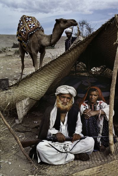
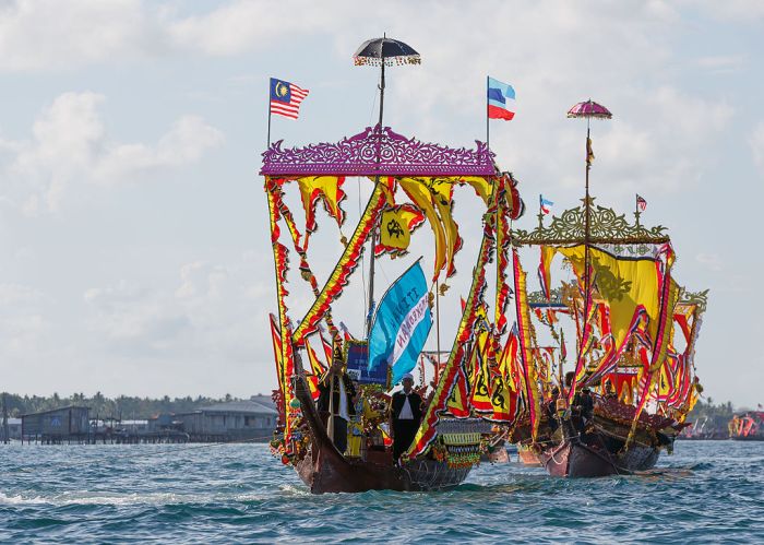
Sama-Bajau have sometimes been called the “Sea Gypsies” or “Sea Nomads”, terms that have also been used for non-related ethnic groups with similar traditional lifestyles, such as the Moken of the Burmese-Thai Mergui Archipelago and the Orang Laut of southeastern Sumatra and the Riau Islands of Indonesia. The modern outward spread of the Sama-Bajau from older inhabited areas seems to have been associated with the development of sea trade in sea cucumber (trepang).

sabah1

Sabah_West_Coast_Bajau_women_in_traditional_dress

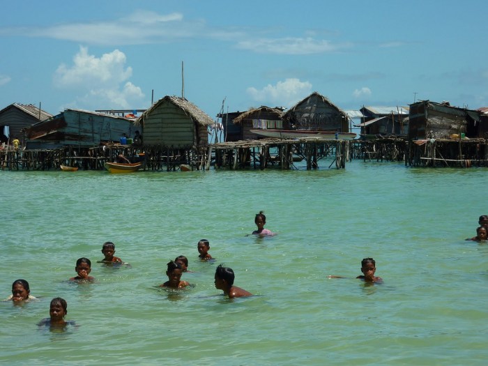
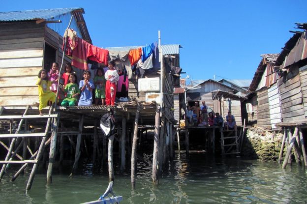
A few Sama-Bajau still live traditionally. They live in houseboats which generally accommodates a single nuclear family (usually five people). The houseboats travel together in flotillas with houseboats of immediate relatives (a family alliance) and co-operate during fishing expeditions and in ceremonies. A married couple may choose to sail with the relatives of the husband or the wife. They anchor at common mooring points (called sambuangan) with other flotillas (usually also belonging to extended relatives) at certain times of the year.
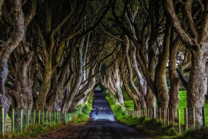
sabah

_100949799_2

Flotilla

Bajau_Laut_Pictures


The Dark Hedges

The Dark Hedges is an avenue of beech trees along Bregagh Road between Armoy and Stranocum in County Antrim, Northern Ireland. The trees form an atmospheric tunnel that has been used as a location in HBO’s popular television series Game of Thrones, which has resulted in the avenue becoming a tourist attraction.

dark

In about 1775 James Stuart built a new house, named Gracehill House after his wife Grace Lynd. Over 150 beech trees were planted along the entrance road to the estate, to create an imposing approach.

dark2

According to legend, the hedges are visited by a ghost called the Grey Lady, who travels the road and flits across it from tree to tree. She is claimed to be either the spirit of James Stuart’s daughter (named “Cross Peggy”) or one of the house’s maids who died mysteriously, or a spirit from an abandoned graveyard beneath the fields, who on Halloween is joined on her visitation by other spirits from the graveyard.

hedge

dark4

dark3

The Dark Hedges were used as a filming location for the “King’s Road” in the television series Game of Thrones. The trees have also been used in the 2017 Transformers film The Last Knight.

Dark-Hedges-Ireland

DARK-HEDGES-IRELAND-570

dark-hedges-reland-alley-beautiful2

Mountain Highway Perils

A very close call!

By a matter of mere seconds, a motorist cruising along a highway in Taiwan missed being crushed by a massive boulder that plummeted to the road in front of them.

The jaw-dropping scene was captured by the car’s dash cam in a piece of footage almost sure to provide viewers with a jolt.

In the remarkable video, the driver’s picturesque journey, punctuated by pop music playing on the radio, is suddenly interrupted when the enormous rock drops from a nearby cliff and hits the road.

The bounding boulder’s impact causes it to crack up into a few pieces and, amazingly, the largest chunk also narrowly misses smashing into the car, making the driver doubly lucky that day.

Fortunately, the vehicle was no worse for wear after the close call, which is rather miraculous when one considers what it would have looked like if the timing were different.

Mountain Vault

granite2

The Granite Mountain Records Vault (also known simply as The Vault) is a large archive and vault owned by The Church of Jesus Christ of Latter-day Saints (LDS Church) excavated 600 feet into the north side of Little Cottonwood Canyon near Salt Lake City, Utah. The Granite Mountain facilities feature a dry, environment-controlled facility used for long-term record storage, as well as administrative offices, shipping and receiving docks, a processing facility and restoration laboratory for microfilm.

Records stored include genealogical and family history information contained in over 2.4 million rolls of microfilm and 1 million microfiche. This equals about three billion pages of family history records. The vault’s library of microfilm increases by up to 40,000 rolls per year. Since 1999, the church has been digitizing the genealogical microfilms stored in the vault. The church makes the records publicly available through its Family History Centers, as well as online at its FamilySearch website.

There is a second vault, two miles further up the canyon. However, this vault is owned and operated by Perpetual Storage Inc., and run for-profit.

granite

granite1

granite6

sb10065616b-001.jpg

granite4

granite5

Colorful Landscapes

One of the best examples of colorful landform is on Mount Danxia, in Guangdong Province, in China. The Danxia landforms are made of strips of red sandstone alternating with chalk and other sediments that were deposited over millions of years, like slices of a layered cake. Over 700 individual locations have been identified in China, mostly in southeast and southwest China, where this type of colors and layers can be seen—all of these are referred to as Danxia landforms.

danxia-landform-1

danxia-landform-2

danxia-landform-3

The Hill of Seven Colors, Purmamarca

About 70 km south of Humahuaca is another rainbow-colored hill—Cerro de los Siete Colores, or the Hill of Seven Colors, located near the tiny village of Purmamarca, in north-western Argentina. The hill was formed by a complex geological process that involved deposition of sea, lake and river movements and subsequent elevation of the land due to the movement of the tectonic plates about seventy-five million years ago. It is said that you can see seven colors in the hill, but most people can pick out only four. The colors are most clearly visible in the morning.

cerro-siete-colores-1


cerro-siete-colores-2

cerro-siete-colores-3

Ausangate Mountain

The Ausangate mountain, about 100 kilometers southeast of Cusco, in Peru, is also known as Rainbow Mountain or Cerro Colorado because of its exposed layers of rock bearing red, ochre, and turquoise colors. The mountain is considered to be holy and believed to be the deity of Cusco by local Peruvians. It is a site of daily worship and offerings by local citizens. Every year thousands of Quechua pilgrims visit the Ausangate Mountain for the Star Snow festival which takes place a week before the Corpus Christi feast.

ausangate-rainbow-mountain


ausangate-rainbow-mountain-2


Painted Hills of Oregon

The colorful layers and banded striations that make up the Painted Hills in Wheeler County, Oregon, the United States of America, were formed over 35 million years ago by volcanic ash layers deposited by ancient eruptions when the area was a river plain. Over time, the layers of ash containing different minerals compacted and solidified into the various bands of colors seen today. The black soil is lignite that was vegetative matter that grew along the floodplain. The grey coloring is mudstone, siltstone, and shale. The red and orange hues are from laterite soil that formed by floodplain deposits when the area was warm and humid.

painted-hills-oregon-1


painted-hills-oregon-2


painted-hills-oregon-3

The Red Earth Terraces of Dongchuan

Some 250 kilometers northeast of Kunming, the capital of China’s Yunnan Province, lies Dongchuan, a rural area with the world’s most imposing red earth. Spread over vast terraced fields, Dongchuan’s unusual brownish-red color comes from its rich deposit of iron and copper. Exposed to the warm and humid climate of Yunnan, the iron in the soil undergoes oxidization to form iron oxide which is naturally red in color. These oxides, deposited through many years, gradually developed into the extraordinary reddish brown soil seen here today. Every year during spring, when this area is ploughed for agriculture, a large number of visitors and photographers come to see squares of freshly upturned red earth waiting to be sown along with areas of budding green plants. The fiery red soil juxtaposed with emerald green barley, and golden yellow buckwheat, against a blue sky produces one of the richest color palate rarely seen in nature.

red-earth-dongchuan-1


red-earth-dongchuan-2


red-earth-dongchuan-3


Canadian, Texas

Canadian is a city in and the county seat of Hemphill County, Texas, United States. The population was 2,649 at the 2010 census. It is named for the Canadian River, a tributary of the nearby Arkansas River. Incorporated in 1908, Canadian is sometimes called “the oasis of the High Plains.” Canadian is on the eastern side of the Texas Panhandle adjacent to Oklahoma.

canadian3

canadian

canadian1

It is unclear why the river is called the Canadian. On John C. Fremont’s route map of 1845, the river’s name is listed as “Goo-al-pah or Canadian River” from the Comanche and Kiowa name for the river (Kiowa gúlvàu, (IPA: [gúdl-p’ɔː]) ‘red river’). In 1929 Muriel H. Wright wrote that the Canadian River was named about 1820 by French traders who noted another group of traders from Canada (Canadiens) had camped on the river near its confluence with the Arkansas River.

According to the Encyclopedia of Oklahoma History and Culture, Spanish explorers in the 17th and 18th centuries called it the Rio Buenaventura and the Magdalena. The upper part was called Rio Colorado by the Spanish.

A more recent explanation comes from William Bright, who wrote that the name is “probably derived from Río Canadiano”, a Spanish spelling of the Caddo word káyántinu, which was the Caddos’ name for the nearby Red River.

The name could be of Spanish origin from the word cañada (meaning “glen”), as the Canadian River formed a steep canyon in northern New Mexico and a somewhat broad canyon in Texas. A few historical records document this explanation. Edward Hale, writing in 1929, considered the French origin of the name most probable.

canadianxx

canadian2.jpg

canadian4

I’m pretty sure there is no American in Canada. But there is a Arizona, Manitoba.