The American aircraft carrier USS Carl Vinson launching F-18’s during Operation Resolve. They are heading to Iraq or Syria to kick some ISIS ass.

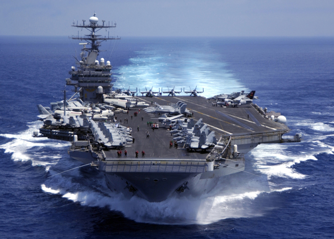
The American aircraft carrier USS Carl Vinson launching F-18’s during Operation Resolve. They are heading to Iraq or Syria to kick some ISIS ass.
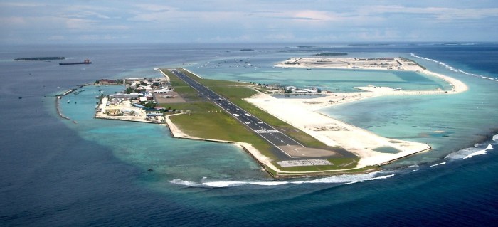
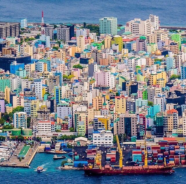
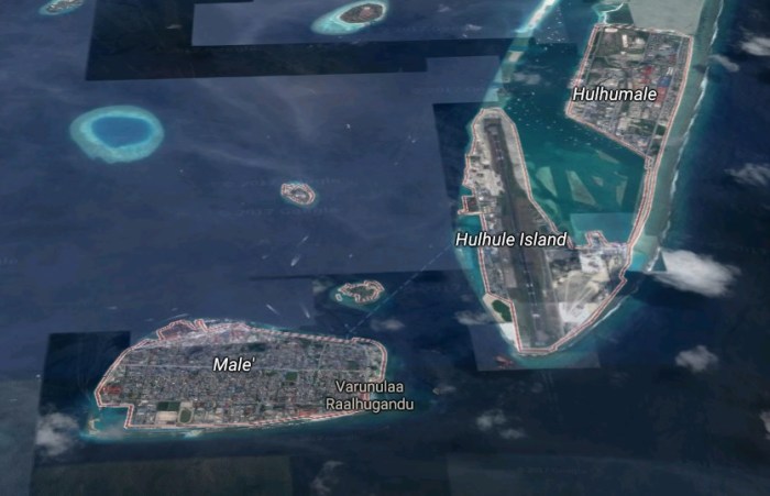
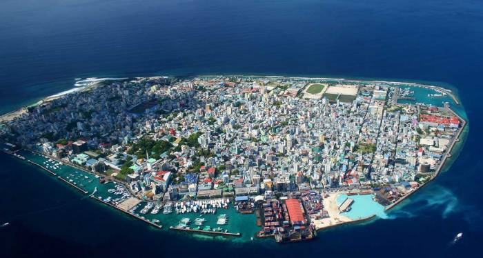
Malé (pronounced Mali) is the capital and most populous city in the Republic of Maldives. With a population of 133,412[1] and an area of 5.8 square kilometres (2.2 sq mi), it is also one of the most densely populated cities in the world.[2] The city is geographically located at the southern edge of North Malé Atoll (Kaafu Atoll).[3] Administratively, the city consists of a central island, an airport island, and two other islands governed by the Malé City Council.

| Country | Maldives |
|---|---|
| Geographic atoll | North Male Atoll |
| Government | |
| • Council | Malé City Council |
| • Mayor | Mohammed Shihab |
| Area | |
| • Total | 5.8 km2 (2.2 sq mi) |
| Elevation | 2.4 m (7.9 ft) |
| Population (2014) | |
| • Total | 133,412 |
| • Density | 23,002/km2 (59,570/sq mi) |
| Time zone | MVT (UTC+05:00) |


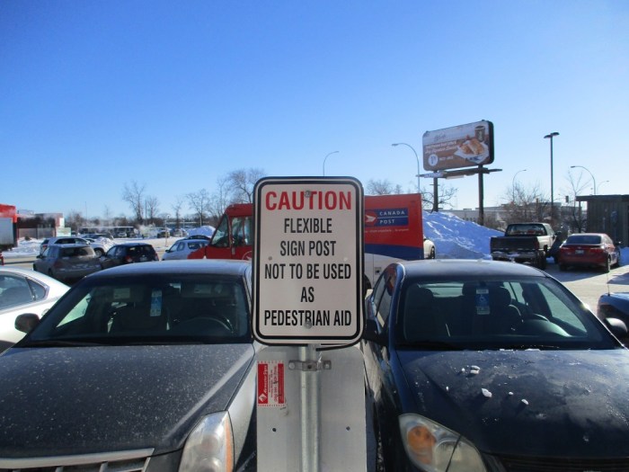
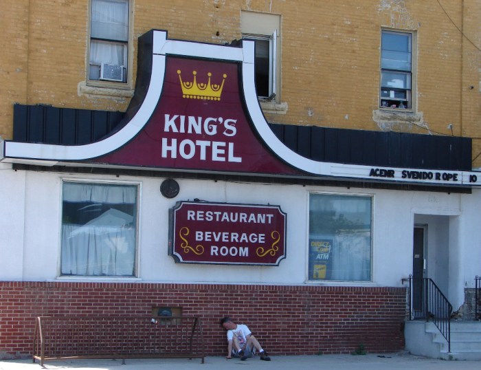
This sign still has me baffled.
Boyd Avenue in the North End.

Horse-head Busker Millennium Library skywalk.

U-Haul through a wall.

New Age on Tache.

Bannock pizza.

Water Taxi from above.

Pan-Am Boxing Club in the Exchange District.
A very fast tag-team tow.

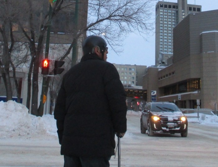
Old guy wearing a helmet while walking. Better safe than sorry.
Harmonica-guitar playing busker on Portage Ave.

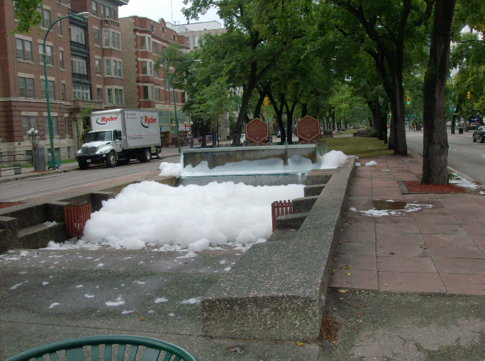
Suds in the fountain at Broadway and Donald.
Speaks for itself.
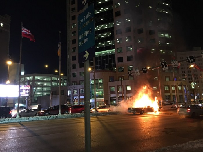
El Camino on fire at Portage and Main
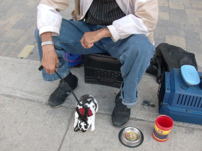
Guy with his pet rabbit on Donald and Ellice.
Americans and their not so great knowledge of geography.
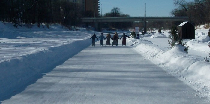
Hutterite girls skating on the river trail.

-30 windchill. A Manitoba March.

Time to head to the Thermea Spa in Fort Garry.


After America’s War of Independence, the Paris Peace Talks took place in 1783. At one point the British were prepared to give up a good chunk of present day Canada. The Red Line Map showed these concessions. However, the Americans were never shown the map and therefore never demanded the Canadian territory.

The red area would have been conceded to the young United States.

Toronto, Montreal, Ottawa, Hamilton and Halifax would all be American today.
How people commute to Manhattan.

World War I map

Native American pre-contact food sources.

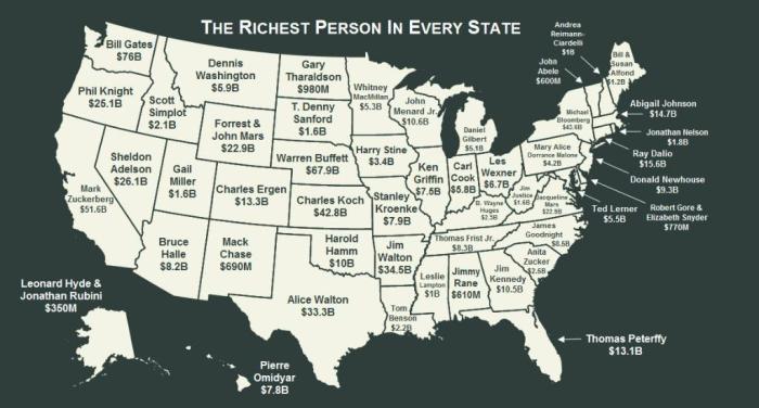
Is America still Number One? Depends on which metrics you use. By at least one measure, China’s economy already is the world’s biggest (1). Other criteria still put the U.S. ahead, at least for a few more years.
This map presents another way to gauge the size of the American economy, and one less prone to the ‘declinism’ of the eternal comparison to China.
By comparing states with countries that have a similar GDP, it demonstrates the formidable size of the U.S. economy. Irrespective of whether it’s second or first, it’s as big as the GDPs of these 51 countries put together.
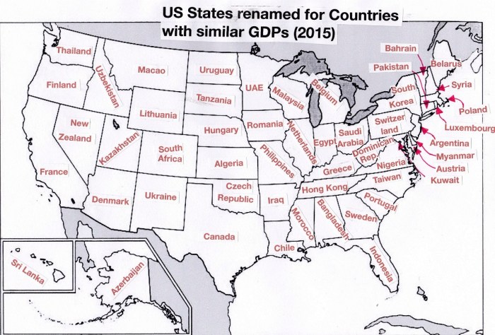
The figures used for the map are from the Bureau of Economic Analysis (for the U.S. states) and the IMF (for the countries). According to the IMF, overall GDP for the U.S. has increased to $17.9 trillion in 2015.
Some things have remained the same: California and Texas still are the #1 and #2 economies in the U.S., and their GDPs are still in the same ballpark as France and Canada, respectively. The third-placed state’s economy is still comparable to South Korea’s, although that state is no longer Florida (down one place, to 2015’s Indonesia) but New York (surging four places, from 2007’s Brazil).
Nevada lost most ground, from 22nd place in 2007 (when its economy was about the size of Ireland’s GDP, at $203 billion) to 34th in 2015 (its $140 billion GDP roughly comparable to New Zealand’s).The biggest winner was Maryland, up from 26th place in 2007 (in the neighborhood of Iran’s $195 billion GDP) to 15th place in 2015 (with a $361 billion GDP comparable to Austria’s).
Washington Post
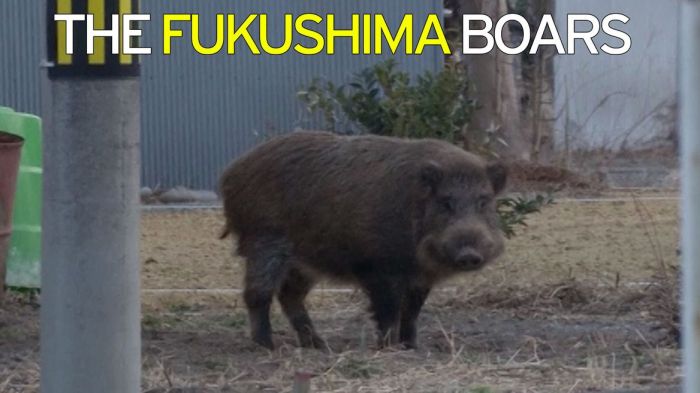
Nuclear catastrophe is always an unmitigated disaster. The only beneficiaries, albeit in a perverse fashion, are animals, which tend to flourish in areas humans evacuate. This has certainly been the case for wild boars around Fukushima, which have multiplied so rapidly, they’ve become a problem for neighboring towns.
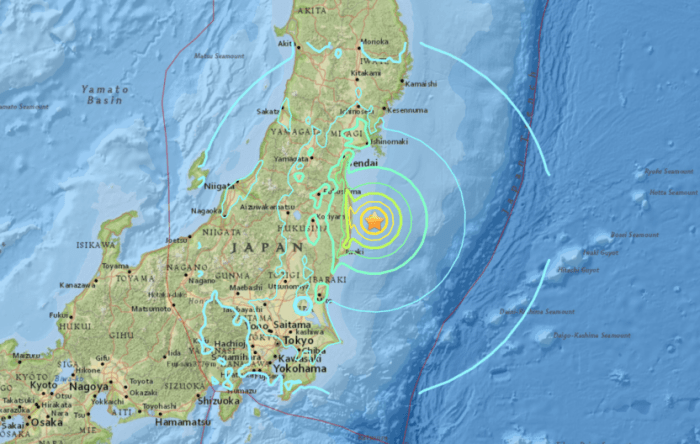
On Friday, March 11, 2011, a 9.0 magnitude earthquake struck offshore near Tokyo and caused a 30-foot high tsunami that crashed into Japan’s coast, killing 18,000 people, according to The Washington Post. Water poured into the Tokyo Electric Power Company’s Fukushima Daichi nuclear power plant, flooding the generators designed to keep the plant’s reactors cool. Later that day, an explosion rocked the plant, and more than 200,000 residents living within 12 miles were evacuated as radioactive material began leaking into the surrounding land. In the ensuing days, two more explosions shook the plant, and several fires broke out.
It was a true nuclear meltdown.

Since 2011, no humans have been able to live on the poisoned land. Wild boars, meanwhile, have thrived heartily. No evidence suggests that the radioactive contamination harms the beasts, and the lack of people there to hunt them has allowed them to breed with abandon.
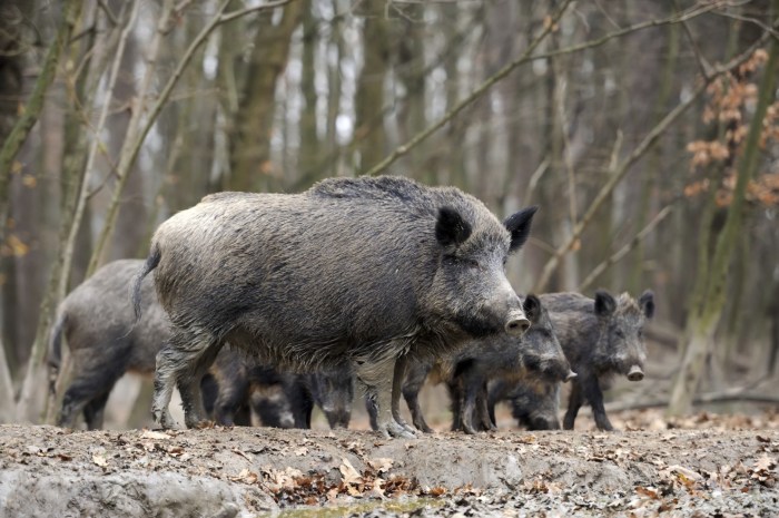
Since the meltdown, the damage wild boars have caused to agriculture by eating crops in the Fukushima area has doubled, reaching ¥98 million or just more than $900,000, according to Yomiuri. That price tag will only rise as the boar population, lacking natural predators, continues to increase–during the past two years, the number of boars that have been hunted has increased more than 300 percent, from 3,000 to 13,000.
Normally, boar meat is highly desired in Japan–in fact, The Japan Times called pork “the nation’s most popular meat”–but these animals have been eating contaminated plants and small animals in the power plant’s “exclusion zone.” The Sunday Times reports recent tests have found high levels of caesium-137 in the area, which has a half-life of 30 years.
These animals are unfit for human consumption, which presents another problem: hunters can attempt to reduce the population, but they have to do something with the carcasses. According to Texas A&M wildlife and fisheries professor Billy Higginbotham, the average size of a male hog is around 200 pounds. Considering this average, if 13,000 are killed, hunters have around 2,600,000 pounds of potentially dangerous flesh requiring disposal.
The best solution would be incinerating the bodies, which requires a special facility that can filter out radioactive materials to prevent the resulting smoke from blanketing nearby areas and contaminating them. One such facility exists in the city of Soma, but the $1.4 million crematorium’s capacity is severely limited. It can only handle three boars a day (or 21 a week, which is only 1,092 each year; not quite 13,000).
The battle between animals and humans has long raged, but for farmers living near the exclusion zone of Fukushima, it’s become a matter of economic survival.

Oh my!
The western and northern areas of Manitoba got slammed with a powerful blizzard over the last couple days. Luckily it just missed Winnipeg and the southeast corner of the province. Now it’s time to dig out and wait for the melt and the inevitable floods.

Brandon, Manitoba

Crystal City, Manitoba
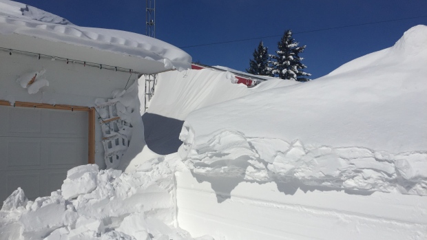
Above and below: St. Leon, Manitoba

Thompson, Manitoba
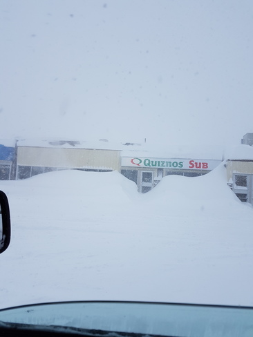

Somewhere in southern Manitoba

BBC

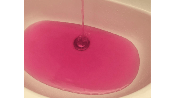
A Canadian town has apologised after a water treatment plant turned the water supply pink.
Residents of Onoway, Alberta, complained to the town office when taps began running pink water on Monday.
In a statement, Mayor Dale Krasnow said there was no public health risk but the town “could have done a better job communicating what was going on”.
The mayor said it was the unfortunate side-effect of a common water-treatment chemical, potassium permanganate.
The chemical is commonly used to remove iron and hydrogen sulphide from water, and the town office said it got into the reservoir when a valve malfunctioned during “normal line flushing and filter backwashing”.
“The reservoir was drained, however some of the chemical still made it into the distribution system.
“While it is alarming to see pink water coming from your taps, potassium permanganate is used in normal treatment processes to help remove iron and manganese and residents were never at risk.”
The chemical can cause skin irritation, according to the World Health Organization, but there were no reports of any adverse effects.
Complaints were more about being kept in the dark – residents said they were annoyed they were not told why the water was fluorescent pink until Tuesday morning.
“This is a situation we can certainly learn from and develop a strategy for better response and communication should we ever face the same or similar situation in the future,” the mayor said.